Introduction from the ViHeritage team:
This long-form chronicle takes readers back in time to the early decades of the 20th century, stepping onto a vast, nearly forgotten land on the administrative maps of that era: the rugged, deep mountainous region in the western hinterlands of Quang Nam and Thua Thien Hue – where the majestic A Taouat mountain (A Tuat mountain is a peak in the Truong Son range, located near the Vietnam-Laos border) stands tall, and where the Cai, Con, and Se-ka-lam rivers wind through sacred, treacherous forests and the chilling legends of the Katu people.
The entire story is narrated through the account of a French official and officer who held the responsibility of station commander at Ben Hien. Moving beyond the perspective of someone tasked with security and military duties, the narrative lens carries the distinct style of an explorer and cultural anthropologist: curious, sharp, meticulously observant of every detail of life, and possessing a special respect for the culture, primitive customs, and the proud spirit of the people living on the frontier.
Distilled and adapted from valuable historical materials – the article “Les Chasseurs de Sang” (The Blood Hunters) by author Le Pichon, do Nguyen Phuoc Vinh Tung translated from the renowned journal Bulletin des Amis du Vieux Hue (No. 4 / 1938) – this chronicle series by the ViHeritage team will recreate a turbulent historical period, when the colonial administration sought to consolidate its control, faced the brutal customs of blood feuds, and gradually touched upon the deep cultural sediments of a people once shrouded in a veil of mystery.
Part 1: A land submerged in fog and the shadows of rumors
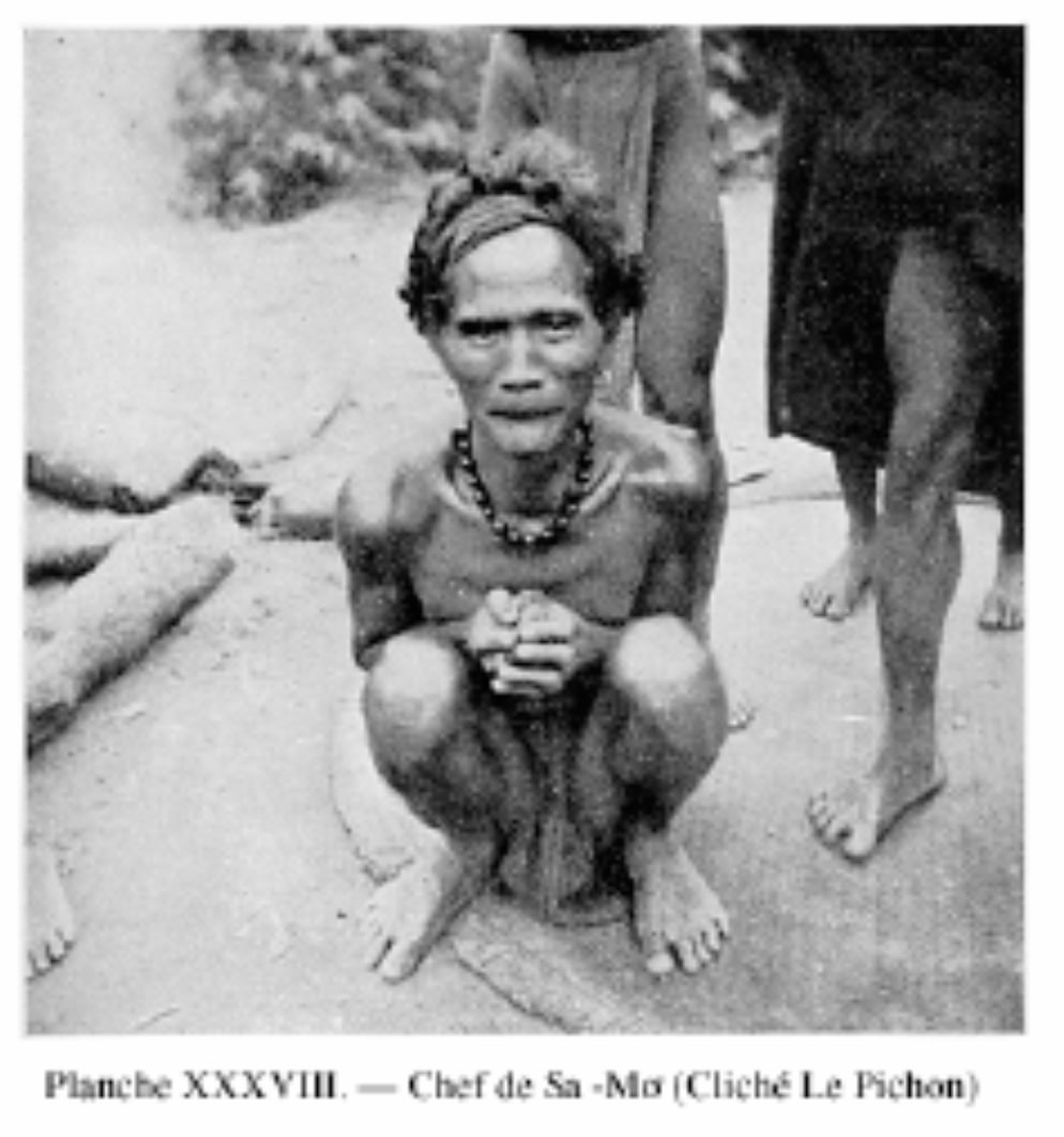
When I was appointed as the station chief and commander at Ben Hien, I must confess, I had never imagined that right on that strip of Annam land, just a few kilometers from the main road, there existed such a vast territory, a place that seemed completely abandoned to oblivion. Its inhabitants were wild people, wearing strange costumes that gave me a sense of primitivity even more profound than the childhood books by Mayne Reid or Cooper that I used to read with such passion.
But setting aside youthful dreams to return to reality, I looked out at the mountain range stretching behind the provinces of Quang Nam and Thua Thien. To the Northwest and North, where the majestic and imposing A Taouat (A Tuat) massif stood as a barrier, people knew almost nothing of what lay hidden within. Around 1900, Captain Debay – then an envoy of Governor-General Doumer tasked with finding a location for a Bana meteorological station – had passed through this region and conducted some geodetic surveys along the route. Before choosing Bana, for the sake of documentation, he had warned about the Tam-R’ehet plateaus located between Dak-Ntroll and Tam-A-Sap (now Dak Nong, Dak Lak) as well as the plateaus on the western slopes of A Taouat. According to him, the inhabitants there were 'Moi' people, very skillful but also extremely prone to raiding. As for A Taouat (A Tuat mountain) itself, he said nothing more than confirming the extremely harsh difficulties of the land and the not-so-friendly nature of those who resided there.
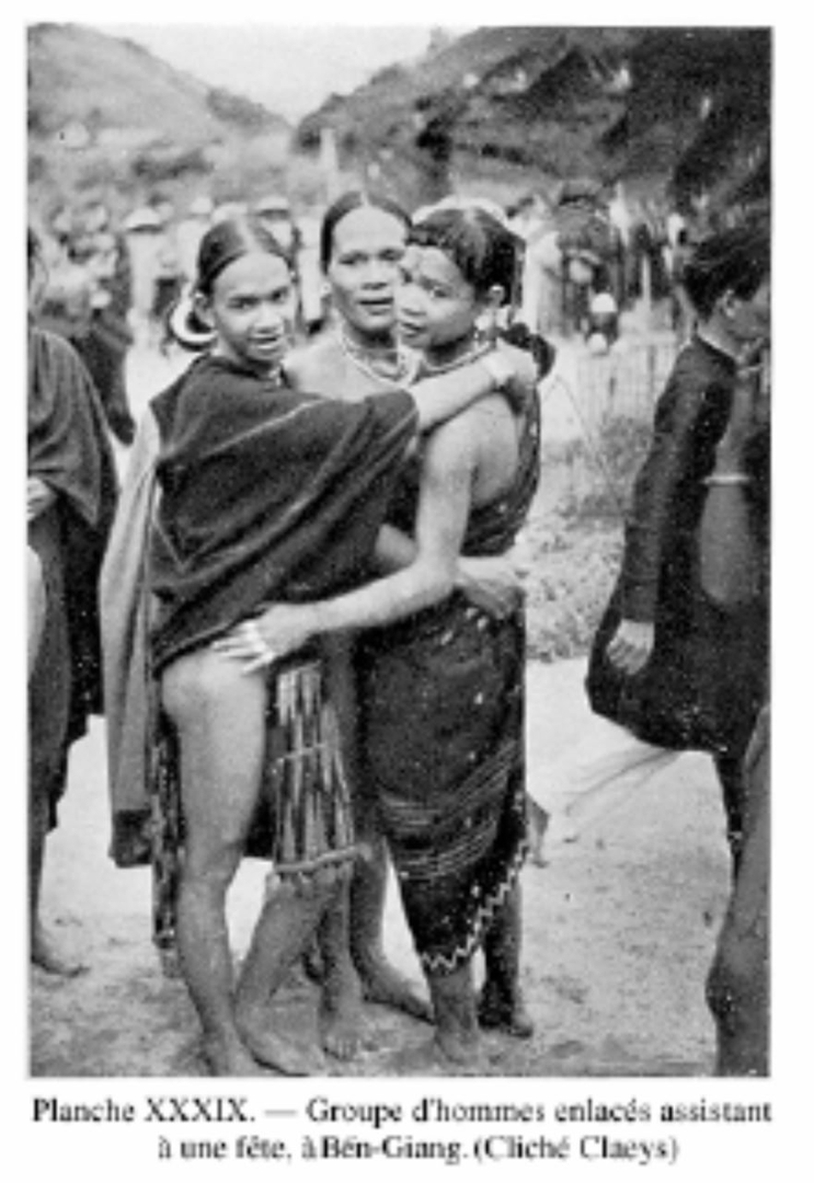
The Annamese people from the lowlands knew these 'Moi' people very well and were terrified of them. In the past, they were forced to organize regular military units to guard the plains, preventing sudden incursions from those wild people. From the very first days we set foot in Annam, this issue became a major concern. After a few shocking assassinations occurred near An Thanh, the establishment of the An Diem station was decided in 1904, and military inspector Kieffer was the first station commander sent to keep the peace. (The area around An Thanh – An Diem is located in the upstream region of present-day Quang Nam, where the lowlands meet the mountains, associated with trade routes and the activities of lowland merchants ("cac-lai") who went up to trade with the Co Tu people, as well as the administrative and military activities of the French as they pushed deep into the Truong Son range.)
However, despite numerous punitive expeditions being organized, murders continued to recur every year, and that land remained as mysterious as ever. It was not until Mr. Sogny – Chief of the Military Security Service, who later became the Chief of Secret Police in Hue – arrived and spent many years attached to An Diem that we began to have our first insights into the 'Moi' community residing there as well as the cultural geography of this mountainous region. By 1913, Mr. Sogny was able to confirm that these 'Moi' people actually constituted a distinct race with a unified foundation. He personally surveyed 250 villages, estimated the population at 10,000, officially named them Ka-Tu, and laid the first bricks for the study of their language and customs.
Then Mr. Sogny also had to leave, leaving behind unfinished notes and a frontier region still shrouded in the fog of the unknown. For many long years thereafter, those subtle insights were buried under the dust of time and colonial rule. The Katu people once again sank into the oblivion of the deep forest, from which they only emerged through violent incidents and bloody acts of revenge.
Yet, that wall of silence could not last forever. As Route 14 was opened and research steps continued to head upstream, a new chapter, painful yet full of shocking anthropological discoveries, was about to be unveiled...
We invite readers to continue to Part 2: A close-up of the life of the Ka-tu people in the great forest to delve deeper into the rugged geographical picture, where the rhythm of life, the soil, and the true appearance of the Katu people gradually take shape ...
Ready for the journey?